
Frozen Lizard
stats:
6.6 mi rt
max: 1939 ft
gain: ~1900 ft
gpx track, use at your own risk: Blanchard
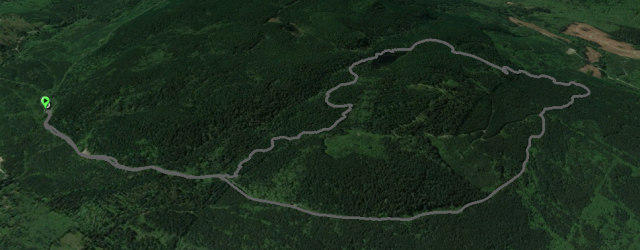
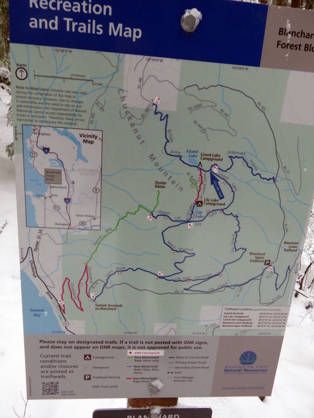
There are so many trails up here on Blanchard Mountain. The mountain is both DNR as well as private timber holdings. Most of the trails on the DNR are established sanctioned trails, most of the ones on the private property are motorcycle/mountain bike trails that are user built and maintained.
I have walked on most of the trails over the years, today’s goal was to find a new to me bike trail. My hiking records go back to 2009 and I think it was about then that I started going up Blanchard on these trails. I put out caches at the start of the Incline Trail (now diverted to the not so quite steep Alternate Incline Trail) as well as on the British Army Trail (BAT). At the time mine were the only ones, now they are every 0.25 mile or so on the roads and many of the trails…too many in my opinion and I believe that when this area was saturated with caches that I stopped geocaching.
My intent was to go up on the Alternate Incline Trail to Lizard Lake and to find the trail at the end of the lake that branches off from the BAT. There was a lot of snow so I wasn’t sure I would find it so plan B was doing the loop with the BAT down to the roads and out.
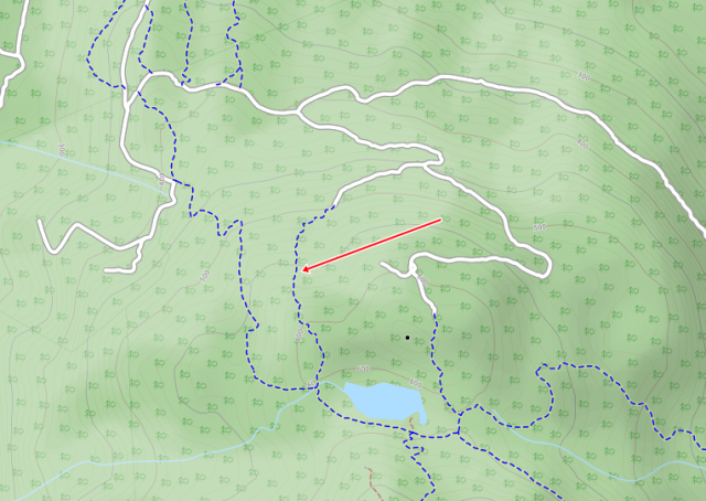
Several years ago I walked out to the end of the spur that now has the trail on it. In the dark recesses of my mind I might remember seeing a rough trail at that time. I have connected the next spur down with the Alternate trail with a short ~400 ft cross country connection.
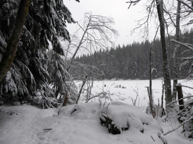
almost to Lizard Lake
Hard to get lost these days on our local hills
I parked in the snow at the Blanchard Upper Trailhead parking seen on the map above and headed up the road. I had thoughts that I would be the only one up there but as usual, Bellinghamsters proved that we are outdoor loving people and there were a few cars at the parking. It is a big mountain and while there were boot prints in the snow, I didn’t see anyone else all day.
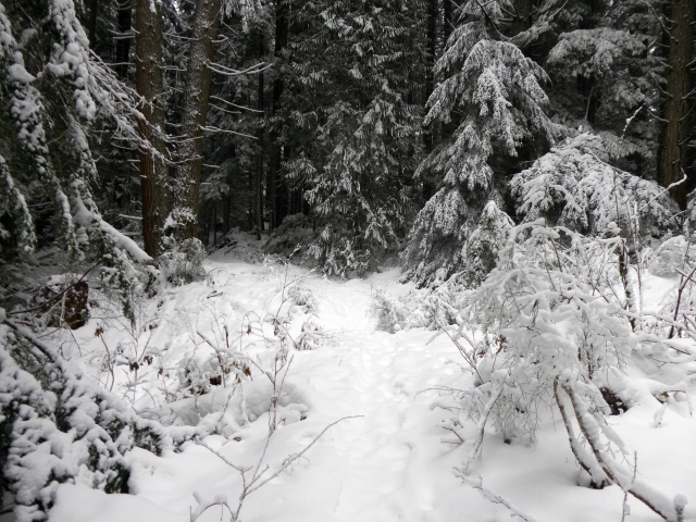
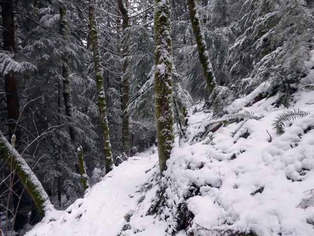
It is about a mile up to where the Alternate Incline Trail leaves the road heading on up the hill. The trail is through a heavily wooded area so there was much less snow on the trail than on the road. The trail up to the junction is just a tad over a mile long and was easy to follow even in the snow. At the junction I headed down the BAT over to the lake, followed the trail past the lake and started looking for the “new” trail.
Perhaps in the snow was not the best time for this trail investigation because it was not obvious to me…plan B it is. I followed the BAT down to near the road then on the Lost Sailor trail to the actual road I planned on walking out on. I was tempted to walk the road out to the end of the spur and approach the “new ” trail that way but I was expected back for family gatherings with the out of town in-laws that were visiting so I just stayed on the roads back to the car.
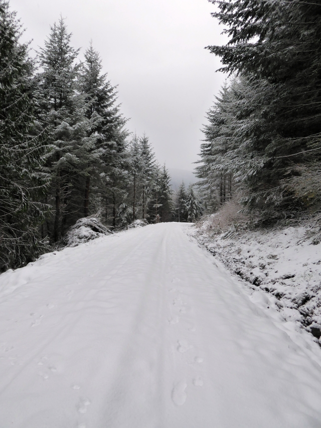
It snowed most of the day while I was on the hill and the distance views were not to be had. None the less, it was a beautiful day to be out walking. I will have to come back when there is no snow and continue my exploration.

Pingback: Blanchard and Stewart, weekend of 3.04.17 | gambolingwithmonique